HUGHLETT POINT NATURAL AREA PRESERVE
The Hughlett Point area, is what brought the Dividing Creek Association into being. Through the efforts of the Dividing Creek Association, the Audubon Society and the Virginia Department of Conservation, the development of a marina/resort complex on Hughlett Point was averted. Through these efforts the Hughlett Point Preserve was established and brought into the Department of Conservation and Recreation’s Natural Area Preserves Program.
The property is now under the care of the Department of Conservation and Recreation and a group of volunteers, many of whom are association members
The association is vitally interested in supporting the Hughlett Point Preserve and other areas in the Dividing Creek watershed. A portion of Dividing Creek Association’s members dues is donated to the Hughlett Point Foundation annually. Dividing Creek Association Members are encouraged to participate in the support of and the activities at the Hughlett Point Preserve.
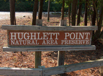
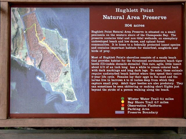
The State Acquisition of the Property in the 1990s
Hughlett Point is a 213 acre parcel of land situated at the tip of Ball’s Neck, the easternmost point of the north side of Dividing Creek in Northumberland Co., Virginia. It encompasses sandy beach and low dune bay frontage, estuarine creek shore, tidal and upland wetlands, pine and hardwood forest, and fresh water ponds. It shelters many plant and animal species, including the bald eagle and the endangered Northeastern Beach Tiger Beetle.
In 1990 the Northumberland Co. Board of Supervisors approved the application of a private owner of the parcel to develop the area into a resort with a motel, a 500 seat restaurant, and some 40 home sites. Immediate opposition to this approval was mounted by the neighborhood association organized to fight it, the Dividing Creek Association (DCA), together with Audubon and other environmental groups. That opposition, combined with the large expense of creating a sewage treatment system utilizing lagoons and surface spraying, not to mention the presence of the federally endangered species of beetle, led to the abandonment of the development project.
With the help of DCA leaders and of the newly elected supervisor from the Wicomico District of the county, Henry Lane Hull, the Virginia Department of Conservation and Recreation (DCR) subsequently applied for and received a $654,000 National Coastal Wetlands Conservation Grant to help to acquire Hughlett Point as a Natural Area Preserve. Other grants were awarded by the Virginia Natural Area Preservation Fund and the U.S. Fish and Wildlife Service. The Dividing Creek Association spearheaded efforts to secure local contributions toward the purchase and maintenance of the Preserve. The tract was purchased by the state in the late summer of 1994. The DCA perseveres in a vow it took at the time of the purchase to provide citizen volunteer monitors and interpretive guides, as well as annual financial contributions to the preservation fund.
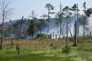
The entire Observation Deck destroyed along with several acres of marshland
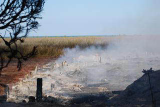
Fire at the Preserve
On AUGUST 31, 2008, the observation platform and some of the marsh at Hughlett Point burned. The fire started sometime around mid-day. Fire companies from Northumberland County, Kilmarnock and the Virginia State Department of Forestry responded as well as the Northumberland Sherriff’s Department and Personnel from the Virginia Department of Conservation and Recreation.
On September 4, 2008 the afternoon breeze apparently fanned some smoldering hot spots remaining from the fire of August 31st into enough of a fire that the fire break created on the 31st was breached. This resulted in the wooded area west of the marsh burning. Firefighters from Kilmarnock and other jurisdictions responded as did Rebecca and a DCR Fire Crew. A back fire was started along the Bay Shore Trail to contain the fire. The next morning there was still a lot of smoke and smoldering and occasional flame, but it was contained within the Bay Shore Trail and the fire break that was cut from the Bay Shore Trail and the North Beach Trail.
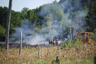
Marsh looking North from where the burned Observation Deck once stood
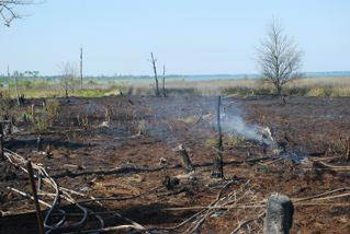
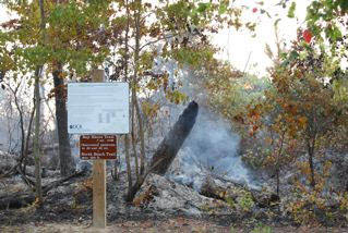
Fire Road at the end of the Pedestrian Board Walk. Picture taken 9-5-2008. Note hot spots are still burning.
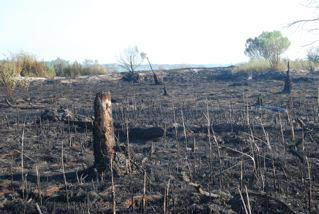
Marsh Area looking North burned to the Beach Trail.
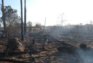
Woods Area burned looking North toward the Beach Trail.